Garmin GPSMAP9010 10in Plotter With Worldwide Basemap
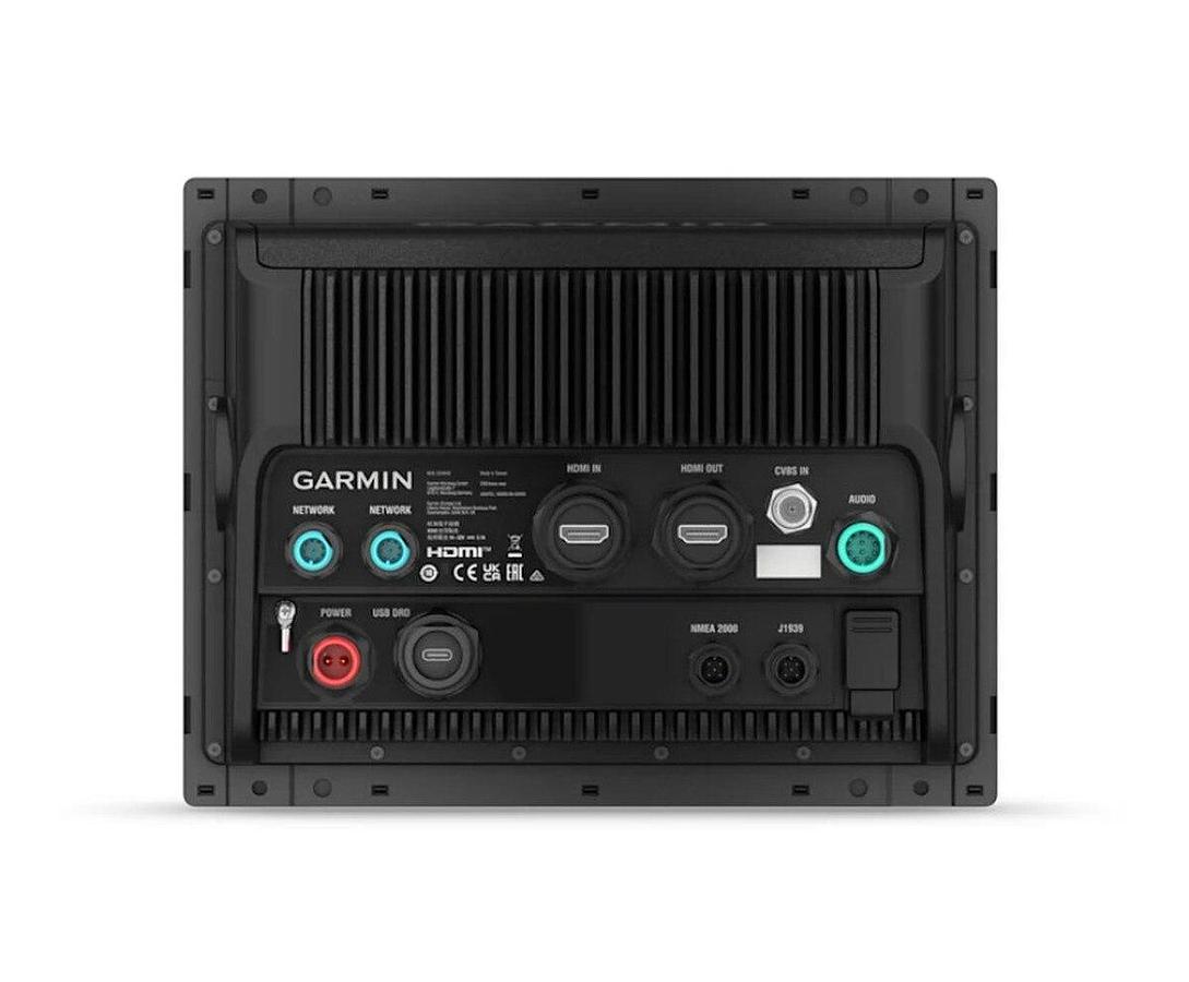
Model: 010-03175-00
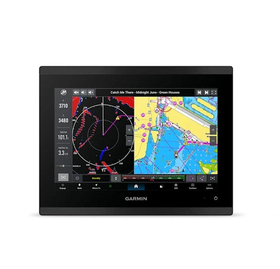
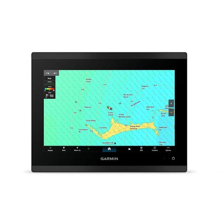
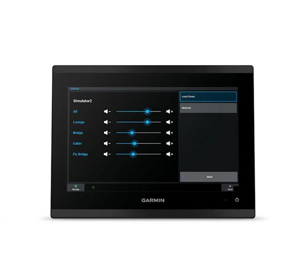
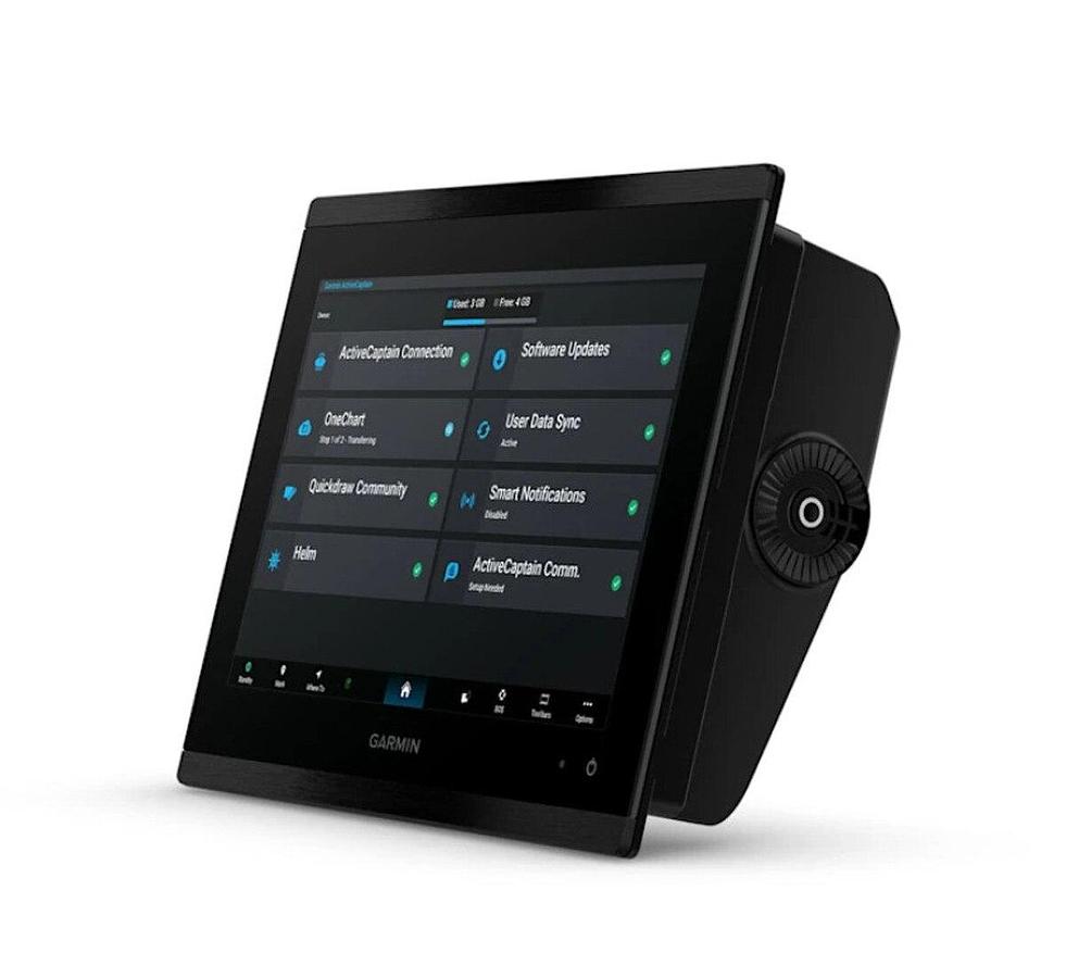
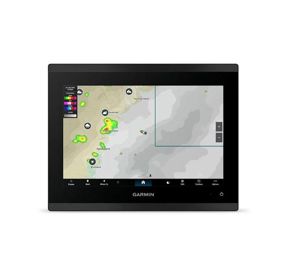
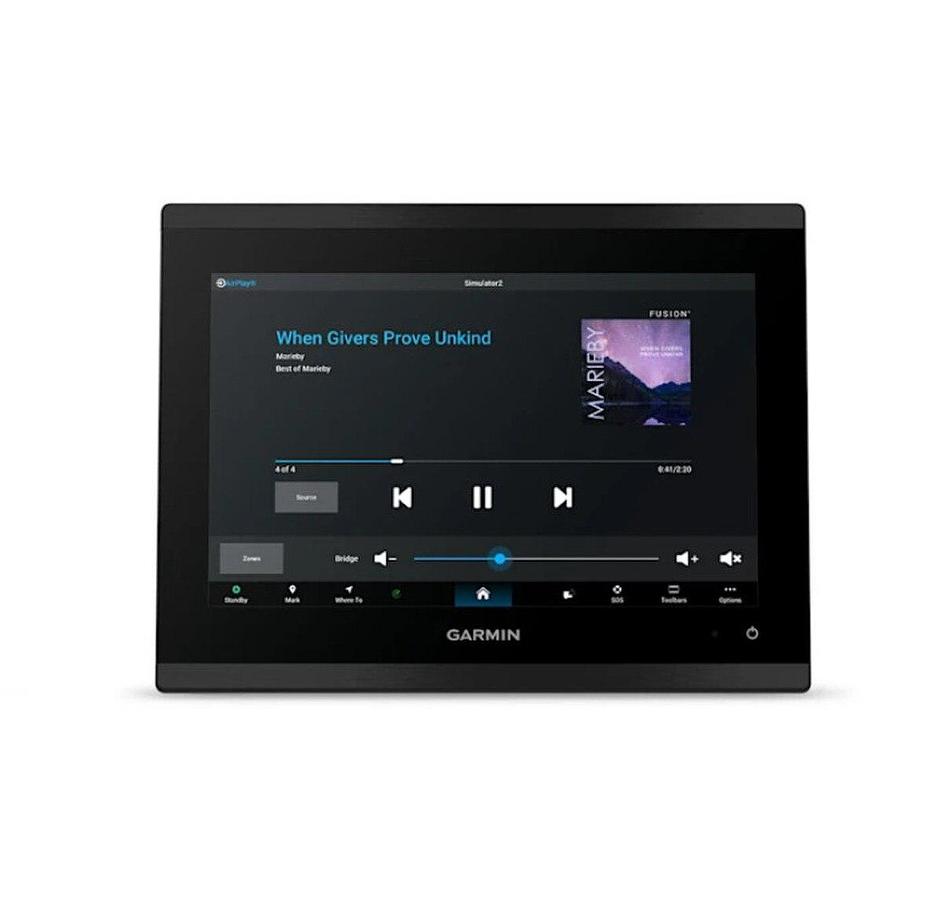
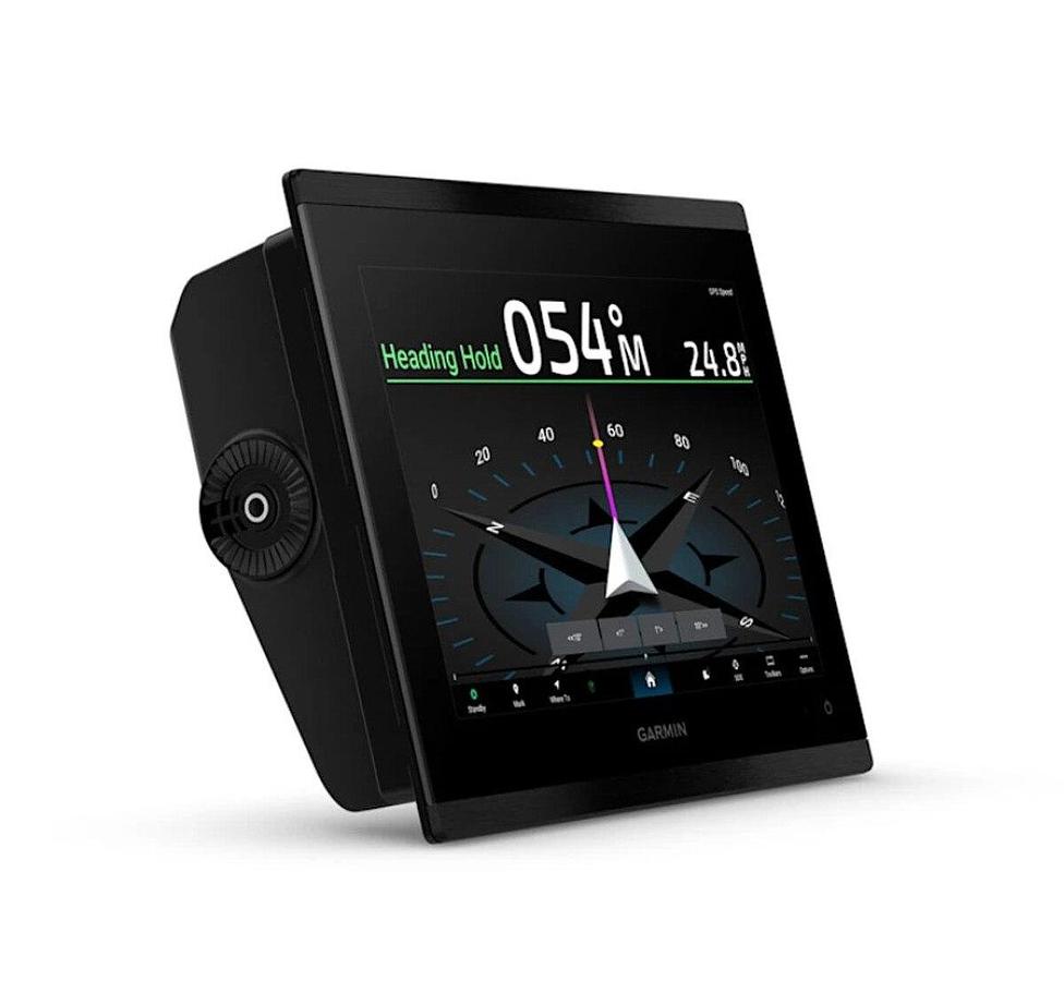
10in model features full HD displayGlass helm with edge-to-edge design for seamless and modern lookProcessing power is up to 7 times faster than previous generations for superior performance, plus get faster wireless ActiveCaptain(R) app transfer speeds with 5GHz Wi-Fi(R) connectivityEnjoy premium sailing features, such as sailing polars, plus see laylines, race start line guidance and more with Garmin?SailAssistTM featuresBuild extensive networks with reliable connectivity and gigabit speeds on the Garmin?BlueNetTM networkEnjoy high-quality entertainment with video integration capabilities with HDCP distributionUses the NMEA?2000(R) and NMEA?0183(R) networks to connect to your compatible autopilots, sensors and more; compatible with existing marine ecosystemsTake command of monitoring, control and automation systems with support for the EmpirBusTM system and other third-party solutions via OneHelmTM integrated digital switchingKeep tabs on engine performance with extensive engine integration, including SAE J1939 connectivity and a wide range of support for outboard engine manufacturersSupport for Garmin?Navionics+TM charts with Auto?Guidance+TM technology (for planning purposes only and does not replace safe navigation operations) and Garmin?Navionics?Vision+TM charts with premium features such as high-resolution relief shadingConnect your compatible Garmin devices and more with integrated BLUETOOTH(R) and ANT(R) technologies; use spoken commands to control the chartplotter with your compatible headset or Garmin smartwatchBuilt for harsh marine conditions with an IPX7 water-resistance ratingGPSMAP(R) 9010 is the integrated touchscreen chartplotter designed for captains who demand the best. Enjoy edge-to-edge clarity with a high-resolution display on a glass helm with premium design and materials. Plot your paradise faster than ever with processing power that's up to 7 times faster than previous generations, and get 5GHz Wi-Fi(R) connectivity for ActiveCaptain(R) app updates. Get a connected boating experience by linking your compatible MFDs, cameras, sonars and more on the gigabit-speed Garmin?BlueNetTM network. The full suite of Garmin?SailAssistTM features allows you to see wind speed, direction and other critical data at a glance. When your hands are full, use spoken commands to operate the chartplotter (compatible headset or smartwatch required; not included). Navigate on the water with support for Garmin?Navionics+TM charts, or upgrade to premium Garmin?Navionics?Vision+TM charts. Garmin?Navionics+ includes a 1-year subscription for daily chart updates and support for Auto?Guidance+TM technology, which helps you navigate and avoid land- and water-based obstacles based on chart data (for planning purposes only and does not replace safe navigation operations).
SpecificationsWEIGHT
| 5.55 lbs (2.52 kg) |
| DIMENSIONS (HxWxD) | 10.24in x 7.87in x 3.54in(26.0 cm x 20.cm x 9.1 cm) |
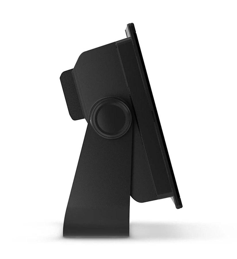
What's in the Box:ChartplottermicroSDTM preinstalledPower cable2-meter backbone/drop cable and T-connector for the NMEA 2000(R) networkFlush mount kitBail mountProtective coverDocumentation